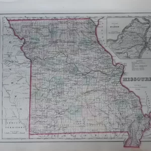
Alvin Jewett Johnson was originally a bookseller who later in his career turned his attention to publishing maps, atlases and books. He ran the publishing house in New York City that published Johnsons’ Family Atlases from 1860 to 1887. These atlases are very fascinating because the sequence of atlas maps documented the growth of the United States during this quarter century. Step by step, the expansion of railroads and the development of new states, counties and cities are depicted.
- illustration: a map of the entire state of Iowa and the eastern parts of Nebraska by A.J. Johnson and R. Browning
- year: 1855
- quality: good
- signed: in plate
- image size: 31.2 cm x 42.6 cm | 12.3 x 16.8 in (h x w)
- sheet size: 34.6 cm x 44.7 cm 13.6 x 17.6 in (h x w)