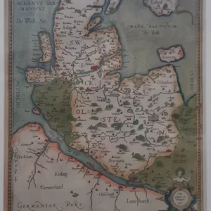
Johann Baptist Homann was a German cartographer, publisher and engraver. In 1702 he established a publishing and trading firm for cartography in Nuremberg, making globes and publishing maps.
Homann’s Circulus Saxoniae Inferioris is a detailed map depicting the Lower Saxon Kreits (Lower Saxony) in the Holy Roman Empire. Many decorations such as cartouches and symbolic images, which is typical of Homann’s style.
- illustration: the map illustrates towns, villages, rivers and administrative boundaries of the region.
- year: ca. 1725
- quality: good
- signed: printed in plate
- image size: 47.6 x 56.3 cm | 18.7 x 22.2 in (h x w)
- Sheet size: no margins