Henricus Hondius is one of the most important Dutch cartographers. He possessed excellent engraving skills and great scientific accuracy. His atlases were a great success because the latest discoveries of Dutch, Spanish and English sailors were incorporated into the maps. Much attention was also paid to embellishing the maps through the use of cartouches, medallions with cityscapes or portraits and coats of arms.
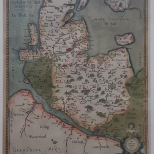
Homann’s Circulus Saxoniae Inferioris is a detailed map depicting the Lower Saxon Kreits (Lower Saxony) in the Holy Roman Empire. Embellishments such as cartouches and symbolic images adorn the card, which is typical of Homann’s style.
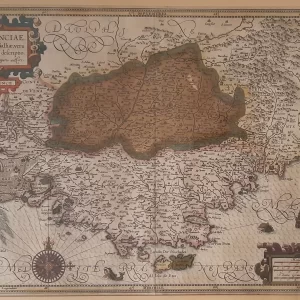
- illustration: the map shows cities, villages, rivers and other geographical features of Lower Alsace. Richly decorated, the map reflects the aesthetic and technical feats of cartography at the time.
- year: ca. 1625
- quality: excellent
- signed: printed in plate
- image size: 36.4 x 43.7 cm | 14.3 x 17.2 in (h x w)
- sheet size: 43.0 x 53.7 cm | 16.9 x 21.3 in (h x w)