Willem Jansz. Blaeu was a Dutch cartographer and globetrotter. To avoid confusion with his neighbor/competitor Janssonius, he added the suffix Blaeu to his name Willem Jansz around 1621. Together with his son Joan Blaeu, Willem is among the world’s most famous cartographers.
His first atlas was published in 1631, with some 60 maps and accompanying texts. Of these 60 maps, 13 had been previously published by Blaeu. Known by the title Appendix, the work was intended to complement the already known atlases of Ortelius and Mercator. This edition can be seen as the second impetus for the fierce competition between the Blaeu firm and the Hondius/Janssonius firm.
After Willem Jansz.’s death, the atlas continued to evolve. This atlas (known as Atlas Maior, Grooten Atlas or Geographiae Blavianae) was to become one of the largest and most expensive editions in the cartographic field during the 17th century. Editions are known to consist of 14 different books and contain around 600 maps.
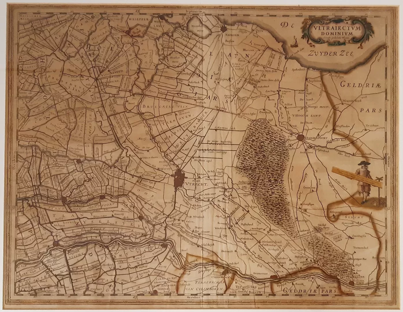
- illustration: nice copy of the Blaeu map of the Domain of Utrecht, old-time colored
- year: ca. 1640
- quality: good, besides crease as issued also some use creases
- signed: printed in plate
- image size: 38.7 x 50.1 cm | 15.2 x 19.7 in (h x w)
- sheet or frame size: 55.2 x 66.3 cm | 21.7 x 26.1 in (h x w)